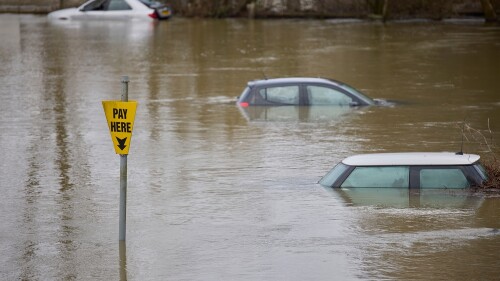
A new definition of what constitutes a 100-year flood promises to drastically alter how commercial and residential properties in Austin are built and protected, panelists said at a ULI Austin event in December.
Kevin Shunk, floodplain administrator for the city of Austin, told the ULI audience that this will be the first major change in the city’s floodplain regulations since 1983.
For years, the city of Austin has based many of its floodplain regulations on the benchmark of a 100-year flood, meaning a storm of that magnitude has a 1 percent chance of happening in any given year. Now, city officials are working on rewriting the regulations so that they correlate with the current 500-year floodplain. This effort arose from new data indicating that major storms in Texas dump more rain than had been previously estimated. The number of buildings within the designated 100-year floodplain—mostly homes—is expected to rise from 4,000 to more than 7,600, according to Shunk. Furthermore, over 3,000 acres (1,200 ha) are in line to be added to the 100-year floodplain.
Nick Moulinet, moderator of the ULI panel and a development services executive at DPR Construction, warned that the impending floodplain overhaul will make Austin “a little bit less affordable” as a place to live and work, due to a spike in development costs associated with meeting the new floodplain measures.
Until the Federal Emergency Management Agency redraws all of Austin’s floodplain maps, the city of Austin’s proposed interim 100-year floodplain is being aligned with the existing 500-year floodplain, Shunk said. Under the interim regulations, owners would confront tougher standards for developing, expanding, remodeling, or improving property inside Austin’s city limits.
City officials are hammering out an update of the land development code that will incorporate the floodplain overhaul. The Austin City Council is expected to take up the code proposal next February or March, according to Shunk.
Shunk noted that uncertainty remains regarding how the city of Austin will handle floodplain compliance for phased, multiyear site plans.
“We don’t have the answers for everything,” he said. “We know there are flood risks out there now, and we know it’s a smart decision to regulate to the flood risks to protect the community from the flood risks that we know exist today.”
The new approach to floodplains in Austin stems from a National Weather Service study released in September 2018 showing that a swath of Texas—extending from Houston in the east, Austin and San Antonio in the middle, and to Del Rio to the west—faces a considerably greater risk of extreme flooding than had been estimated. In Austin, for instance, the projected 100-year rainfall for a 24-hour period jumped from 10.2 inches (25.9 cm) to as much as 13 inches (33 cm), according to the city of Austin.
The study, known as Atlas 14, “is changing our understanding of flood risk in the city of Austin,” Shunk said.
Properties along the Colorado River, which runs through Austin, likely will be excluded from the newly formed 100-year floodplain and instead will stay under the current 100-year floodplain, Shunk said. Why? Because flash flooding typically doesn’t occur along this waterway, which includes downtown Austin’s Lady Bird Lake.
According to the National Oceanic and Atmospheric Administration (NOAA), up-to-date rainfall data for Austin, San Antonio, Houston, and many other communities in Texas will replace rainfall data collected in the 1960s and 1970s.
“The new values are more accurate than estimates developed 40 to 50 years ago due to decades of additional rainfall data, an increase in the amount of available data, both in the number of stations and their record lengths, and improved methods used in the analysis,” according to NOAA.
In September 2018, Wes Birdwell, government relations committee chairman for the Texas Floodplain Management Association, told Scientific American magazine that the Atlas 14 study is a “big deal.”
“We’re the first- or second-fastest-growing state in the country, and we have the second-highest flood damage next to Louisiana, so we needed to do something to improve the quality of our data,” Birdwell said.
Other than broad shifts in development and redevelopment procedures, Shunk and others said that the effects of the new floodplain situation in Austin will include the following:
- An uptick in flood insurance premiums for homes and businesses.
- An increase in the number of roads, treatment plants, power stations, and other infrastructure sites that are at risk of being hit by a 100-year flood.
- Design modifications for retention ponds and drainage systems.
- A lift in “freeboard” requirements for buildings, from 1 foot to 2 feet (0.3 to 0.6 m). Freeboard pushes a building’s lowest floor above predicted flood elevations.
Mark Ramseur, Central Texas managing principal of Pape-Dawson Engineers, told the ULI audience that developers and other real estate professionals in Austin must now focus on the floodplain adjustments during the due diligence phase. During that phase, a developer might need, for example, to carve out 15 percent to 20 percent of a project’s cost for a detention pond under the new floodplain scenario compared with 8 percent to 10 percent under the old scenario, Ramseur said.
“You’re going to see an increased expense in the assessment and due diligence phases of your projects. You can’t avoid it,” Moulinet said. “You need to make sure that you are understanding what you’re dealing with, you need to make sure that it’s identified correctly, you need to make sure that you understand the limits of it, and then you need to go have a conversation with the city. . . . [City staff members] understand the impact that this has.”

![Western Plaza Improvements [1].jpg](https://cdn-ul.uli.org/dims4/default/15205ec/2147483647/strip/true/crop/1919x1078+0+0/resize/500x281!/quality/90/?url=https%3A%2F%2Fk2-prod-uli.s3.us-east-1.amazonaws.com%2Fbrightspot%2Fb4%2Ffa%2F5da7da1e442091ea01b5d8724354%2Fwestern-plaza-improvements-1.jpg)


